Map Your Real-World Signal. Know Your Actual Reach.
Stop guessing how far your signal travels. CopyCall turns your contact logs into clear, actionable coverage maps—showing where your radio actually reaches, where terrain stops it, and how your setup performs across every radio service you operate.
Log In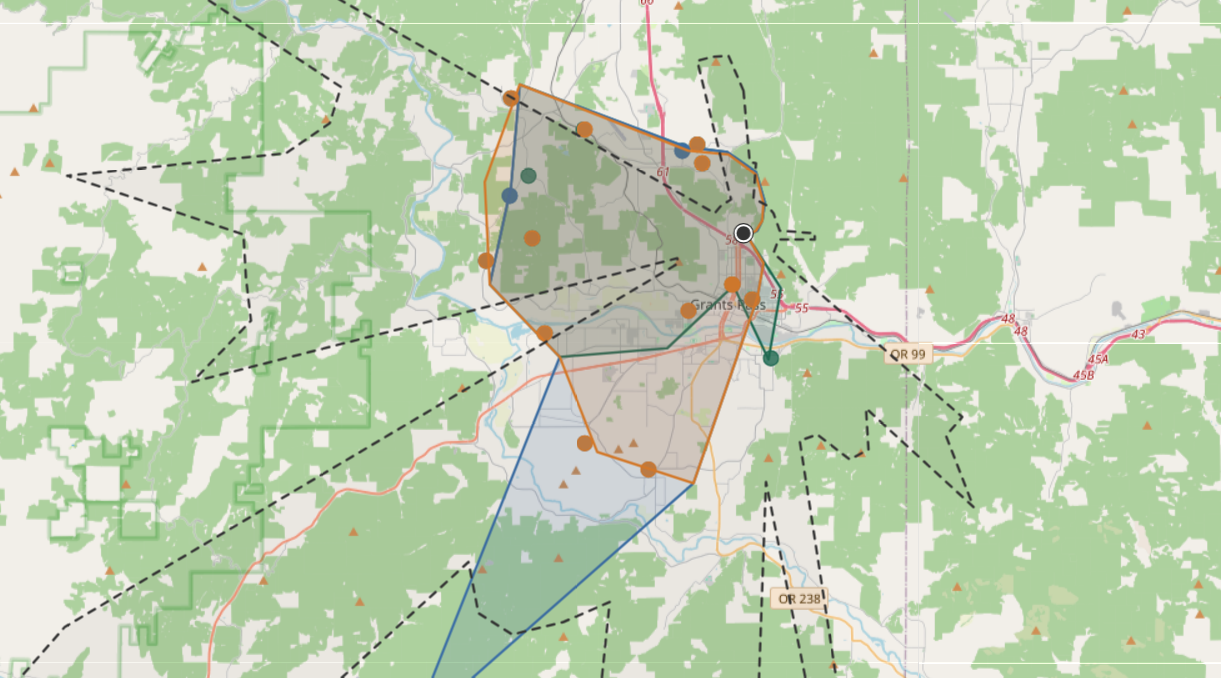
Move Beyond “I Talked Pretty Far”
Traditional logging software tells you who you talked to and when, but it leaves out an important question: how is your station actually performing? Whether you're running a ham radio base station, pushing 50 watts on GMRS, or testing a portable radio on MURS, CopyCall bridges the gap between theoretical propagation models and ground-truth reality.
Actual Reach vs. Theoretical Ceiling
Plot your verified line-of-sight and groundwave contacts directly against geographic terrain models to see where your signal naturally stops—and where it punches above its weight.
Service Agnostic
Built from the ground up for Ham and GMRS, but supports MURS, CB, FRS, Part 90, and just about anything else. Radio operating isn't restricted to a single band, and your visualization tool shouldn't be either.
Built for How You Operate in the Real World
🗺️ Map Real-World Line-of-Sight & Distance
Transform contact points into rich maps. Visually analyze signal patterns, directional nulls, line-of-sight barriers, and range contours over time.
👤 Operator-Centric Mapping
People communicate across multiple services. Link a contact's ham callsign, GMRS callsign, and a handle to a single operator profile. Instantly compare how different bands, antennas, or power levels perform when reaching the exact same station.
⚡ Zero-Friction Data Import
Pull license info, grid squares, and location data straight from the FCC database without tedious manual entry.
Import ADIF or CSV logs from your favorite logging tool or from custom spreadsheets in seconds. CopyCall enhances your existing logbook—it doesn't need to replace it.
🏔️ Terrain & Elevation Analysis
Compare your real contacts against digital elevation models (DEM) to reveal how local ridge lines, valleys, and terrain obstructions may shape your coverage footprint.
One Tool. Every Operating Style.
Emergency Preparedness & EMCOMM
Know your confirmed simplex coverage footprint before the power grid goes down. Build reliable local mesh contact maps for county or neighborhood groups using realistic ground-truth data.
Antenna & Gear Testing
A/B test a new dipole vs. a vertical, or compare 70cm against 1.25m. See exact performance differences mapped out side-by-side.
Simplex Contesting & Field Work
Track mobile, portable, and QRP reach during or after field exercises, summit activations, or local simplex net operations. Follow your standard logging procedure, then import your logs and see how your station performed.
Getting Started with CopyCall
CopyCall is a new service, and access is currently limited to invitation only. We plan to roll this service out for general availability in October of 2026.
Have questions or feedback about this service, or are you a current user in need of support? Email kameron@copycall.org.